WGS84 and ED50 Coordinate Conversion
Perform fast and precise transformations between WGS84 and ED50 coordinate systems using the Coordinator App on your mobile device.
Why Convert Between WGS84 and ED50?
Many older maps and datasets were created using the European Datum 1950 (ED50), which differs from the World Geodetic System 1984 (WGS84) used in modern GPS devices. This difference can result in several meters of spatial displacement if not converted properly.
Coordinator App bridges this gap by offering real-time and batch conversion options between WGS84 and ED50. Whether you're working in construction, land surveying, GIS, or urban planning, using consistent spatial data is essential to avoid misalignments, errors, or compliance issues.
Key Features
- ⚡ Instant coordinate conversion between WGS84 and ED50
- 📂 XLSX batch conversion support
- 🧭 Central meridian and projection selection
- 📤 Export results as Excel file
- 📱 Offline functionality for field use
- 🌍 Available on Android, iOS, and Huawei AppGallery
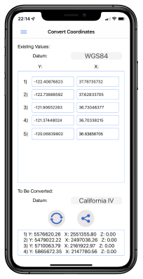
How the Conversion Works
Single Conversion: Select the source and target coordinate systems, enter X and Y values, and get the result immediately. The app also allows for selecting specific central meridians and UTM zones, ensuring regionally accurate transformation.
Batch Conversion: Upload an Excel (.xlsx) file with coordinate data. The first row should be the header, with Y (northing) in the first column and X (easting) in the second. Results are returned in a new file and saved to your device for easy sharing.
This flexibility allows field teams, planners, and engineers to manage both one-off checks and bulk transformations with a single mobile solution.
Download the Coordinator App
Start converting coordinates accurately and efficiently wherever you are.